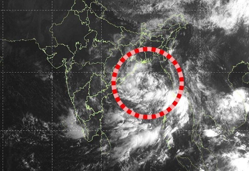
A deep depression over the Bay of Bengal is approaching the North Andhra Pradesh–South Odisha coast, bringing the threat of extremely heavy rainfall, strong winds and rough sea conditions. According to the latest IMD-linked updates, the system is expected to cross the coast between Visakhapatnam and Gopalpur near Kalingapatnam on the night of September 23.
The system is currently expected to make landfall as a deep depression rather than a fully developed cyclone. Winds may reach 55–65 kmph, with gusts up to 75 kmph. The IMD has warned of heavy to very heavy rainfall, with isolated extremely heavy rainfall in parts of southern Odisha and coastal Andhra Pradesh.
Red Alert and Evacuations
Several districts of Odisha are under red rainfall warnings, including areas such as Ganjam, Gajapati and Koraput, while additional districts have been warned of heavy rainfall in the following days. Authorities have prepared shelters and deployed personnel and machinery as a precaution. At least 5,000 people have reportedly been evacuated from vulnerable areas in Odisha.
The weather system is also expected to keep the sea very rough, with fishermen advised to stay away from the sea. Heavy rainfall may continue across parts of Odisha and Andhra Pradesh even after landfall.
Earlier reports raised the possibility that the system could become Cyclone “Arnab”, but the latest IMD-based reporting indicates that cyclone intensification is currently unlikely before landfall.